
-
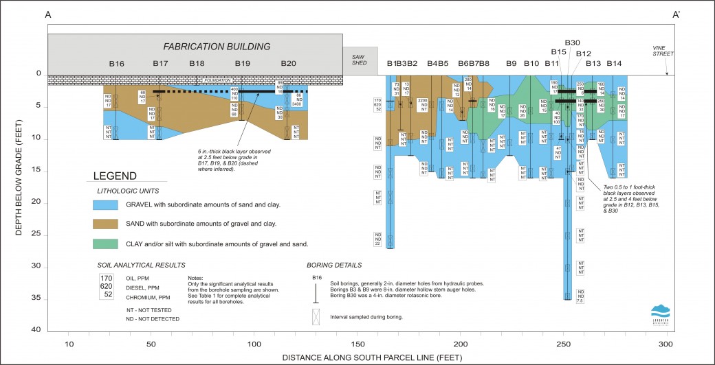 Cross section showing the soil borings used to assess subsurface soil conditions prior to excavation. A direct push drill rig was used to retrieve samples from inside a manufacturing building.
 -
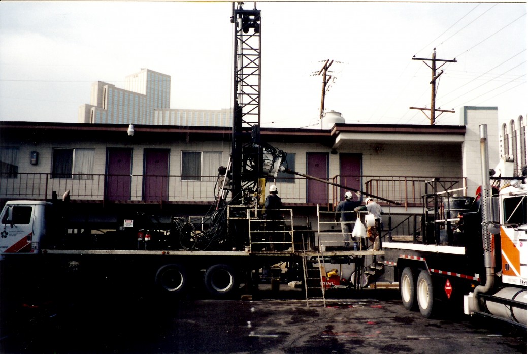 LGS used a rotosonic drill rig to conduct a site investigation in an area underlain by alluvium that contained very large granitic boulders, conditions too difficult for standard hollow stem augers or air-rotary drilling.
 -
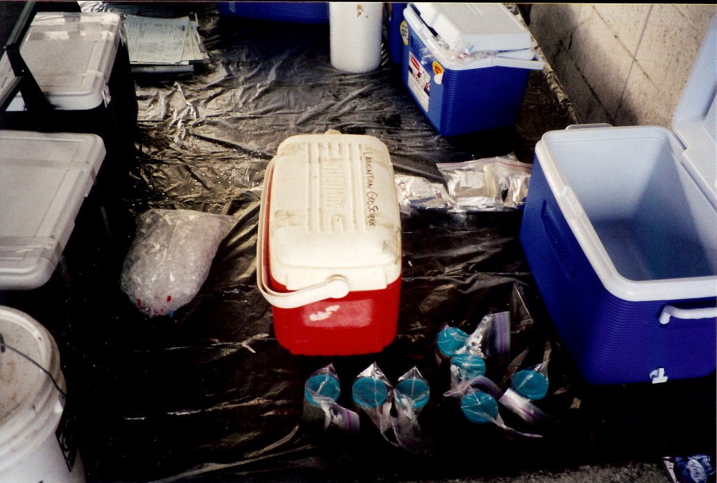 Preparing soil samples for shipment to an analytical laboratory.
 -
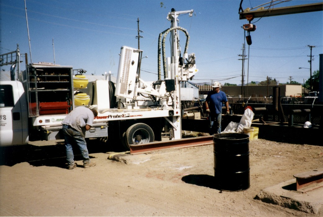 LGS used a direct push drill rig to retrieve soil samples prior to excavation.
 -
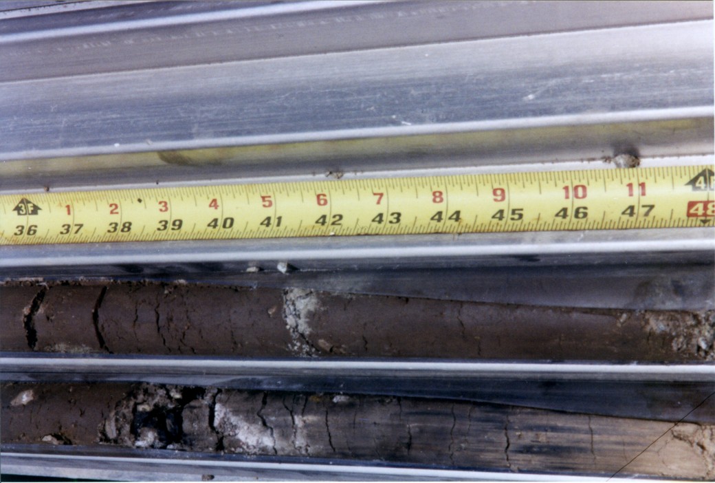 Core samples from the direct push rig show some indication of potential contamination. If the laboratory resuklts had come back positive the excavation spoils would have to be hauled to a special treatment facility instead of being dumped in the spoils pile.
Lahontan GeoScience has expertise in conducting site investigations including geological mapping, soil borings, test pits, groundwater sampling and monitoring well installation. A site investigation refers to the process of determining surface and subsurface conditions in an area of proposed construction. Surface and subsurface conditions may influence what can be built and will directly affect the design and construction procedures relating to how a structure is built. Geological mapping and aerial photo analysis provide information of the type and extent of soils, underlying rock types, and landform development and drainage patterns. Soil borings and test pits provide a visual identification of underlying soil strata and can be used to retrieve samples for laboratory analysis. Groundwater sampling from existing or purpose-built monitoring wells provides data on depth to water, water quality and presence of contaminants.

- New Research on Northern California TectonicsJames Humphrey of LGS and Jeff Unruh of LCI have published a new paper on the tectonics driving defo...
 We’ve Moved!Lahontan GeoScience Has Moved! LGS has moved its office to a new location in south Reno....