
-
Modern Earthquakes in West Africa
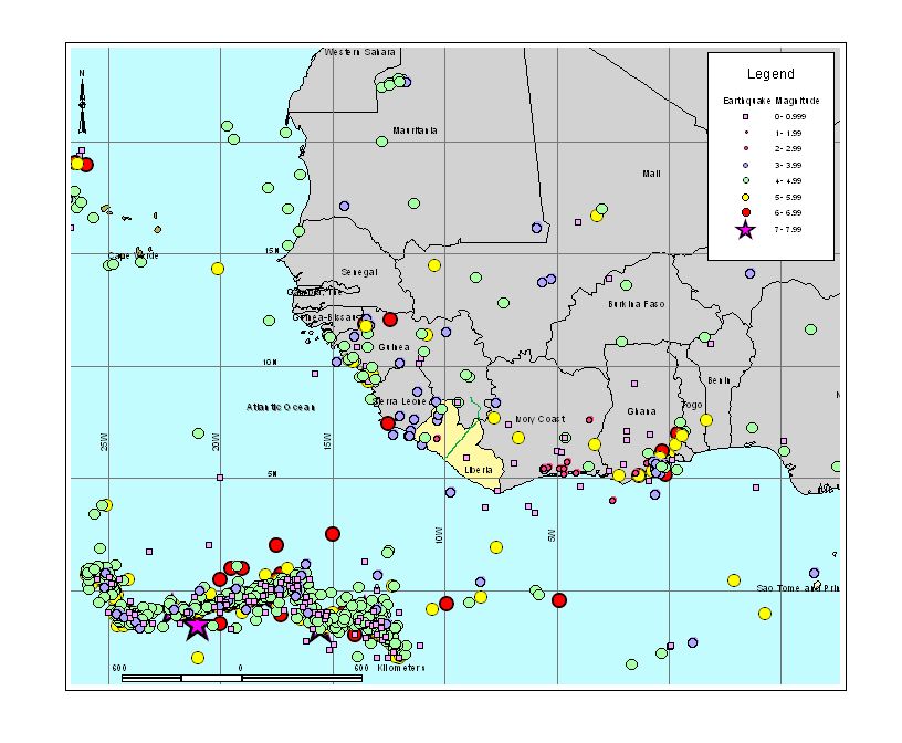
Figure 1. Instrumentally recorded earthquake activity in the West Africa region used for the seismic hazard assessment in Guinea. The cluster of earthquakes in the lower left occurred on the Mid-Atlantic Rift.
Figure 1. Instrumentally recorded earthquake activity in the West Africa region used for the seismic hazard assessment in Guinea. The cluster of earthquakes in the lower left occurred on the Mid-Atlantic Rift.
-
Possible Epicenter of the 1975 Guinea Earthquake
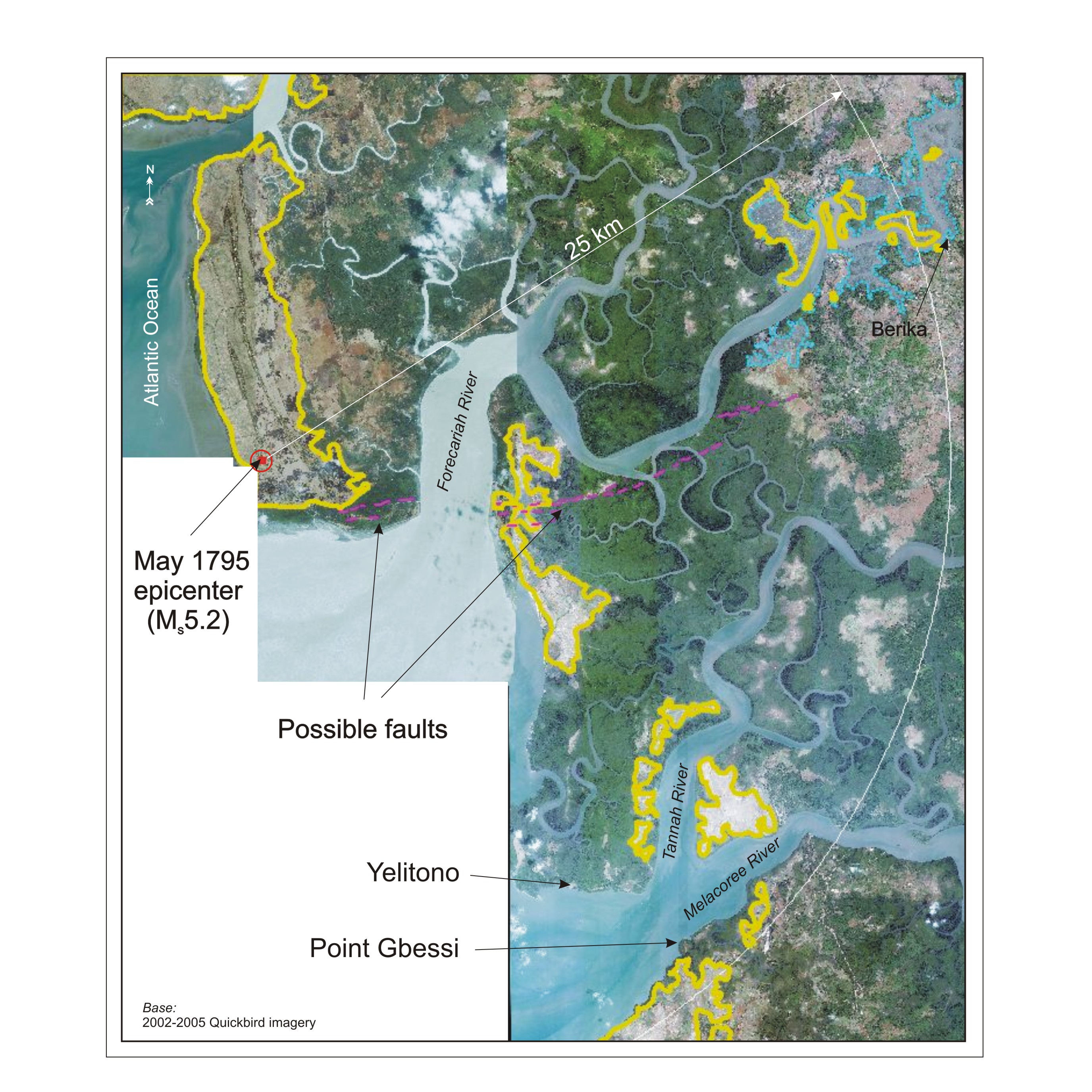
Figure 2. Photo lineaments that may represent surface rupture associated with the 1795 M5+ earthquake in southern Guinea.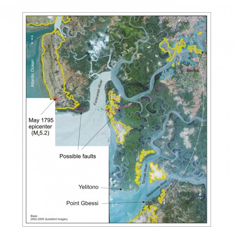
Figure 2. Photo lineaments that may represent surface rupture associated with the 1795 M5+ earthquake in southern Guinea.
-
Surface Ruptures from the 1983 Guinea Earthquake
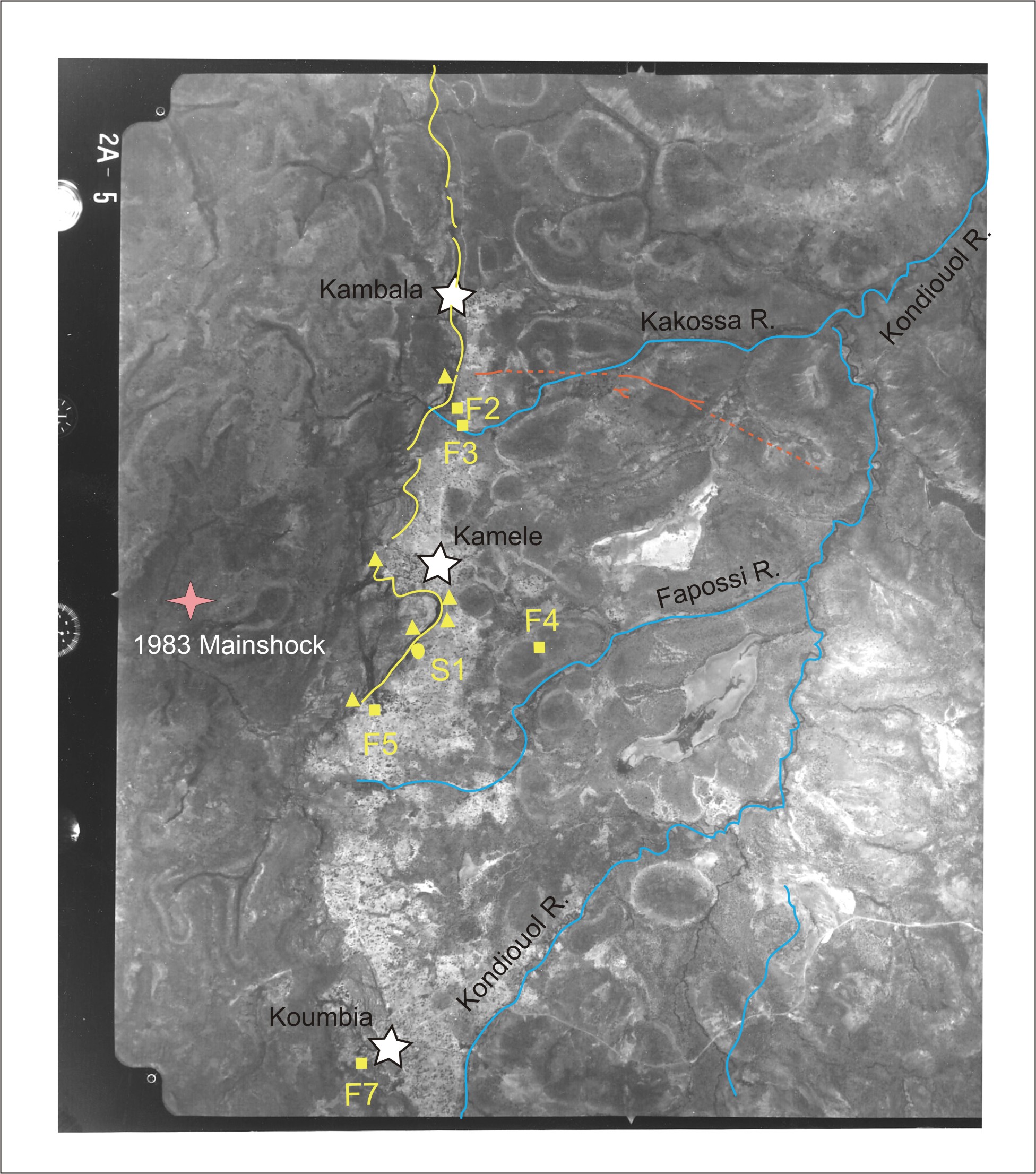
Figure 3. Surface ruptures (orange lines) tentatively associated with the 1983 M6.4 earthquake in northwestern Guinea that caused 300 fatalities and destroyed 18,000 dwellings.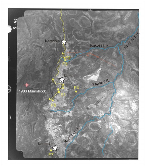
Figure 3. Surface ruptures (orange lines) tentatively associated with the 1983 M6.4 earthquake in northwestern Guinea that caused 300 fatalities and destroyed 18,000 dwellings.
-
LGS Seismic Hazard Specialist in Guinea
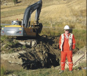
Figure 4. Field mapping of potentially liquefiable sediments near the mouth of the Melacoree River in southern Guinea.
Figure 4. Field mapping of potentially liquefiable sediments near the mouth of the Melacoree River in southern Guinea.
-
Travelling in Southern Guinea
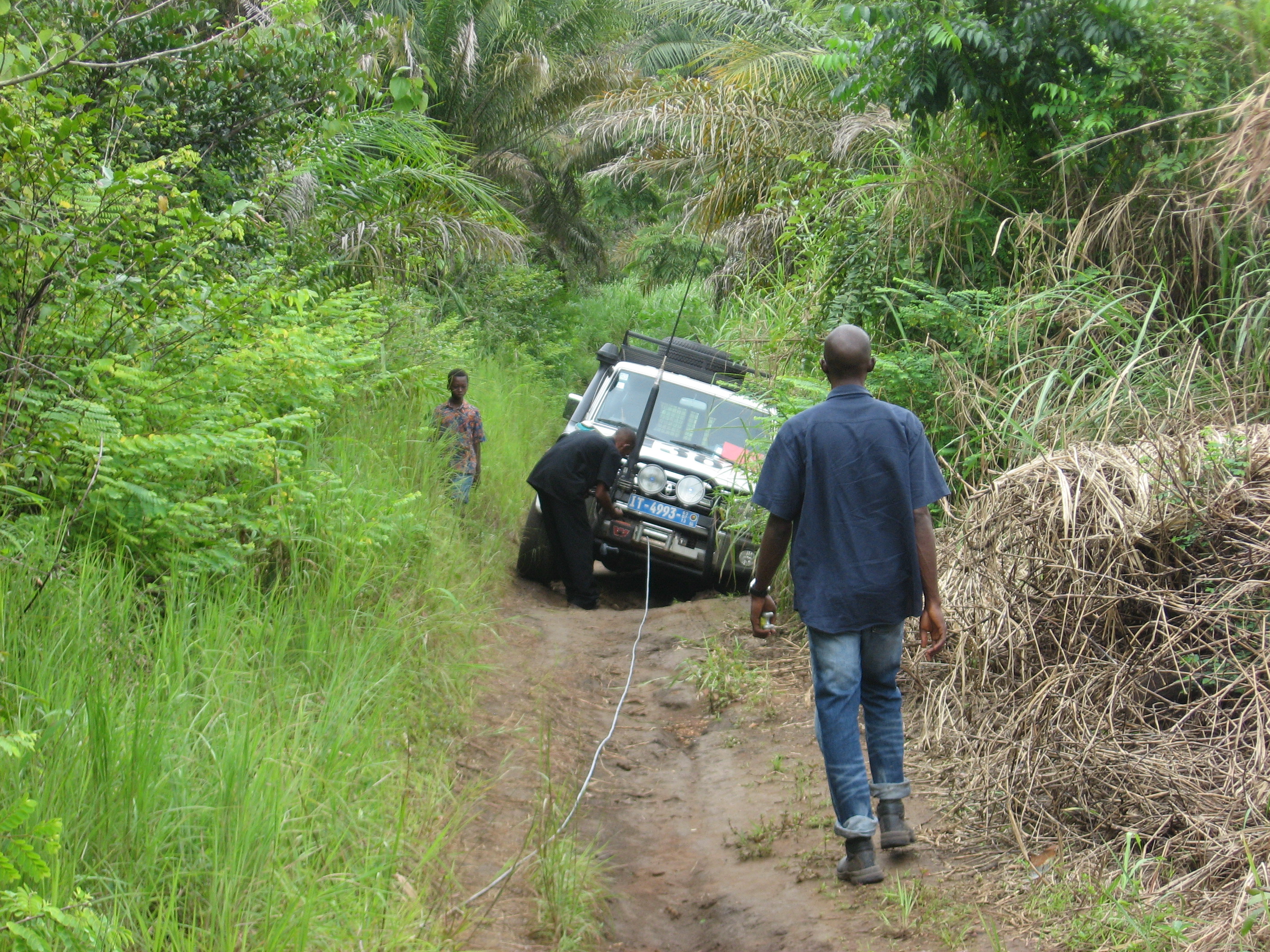
Figure 5. Encountering difficult road conditions near the coast in southern Guinea.
Figure 5. Encountering difficult road conditions near the coast in southern Guinea.
-
Disembarking from a chain ferry in south central Guinea
Figure 6. Disembarking from a chain ferry in south central Guinea during a field excursion assessing geotechnical conditions along a proposed rail alignment.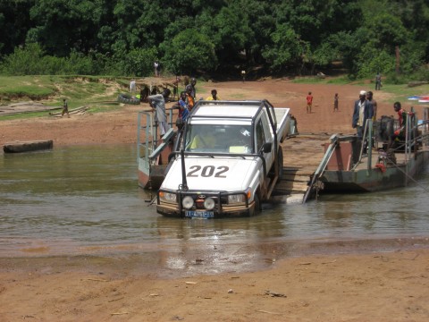
Figure 6. Disembarking from a chain ferry in south central Guinea during a field excursion assessing geotechnical conditions along a proposed rail alignment.
Project Overview
LGS performed a preliminary seismic hazard assessment in Guinea as part of a pre-feasibility study for a project to develop the country’s vast iron ore resources in the Simandou Range. The purpose of this investigation was to provide a first-order evaluation of seismic hazards including surface-faulting hazards, the potential for liquefaction and an estimate of maximum levels of strong ground shaking from earthquakes that could potentially damage infrastructure related to the mine, the rail transport corridor, and the port facility. Work completed by LGS for this project included the compilation of seismological and structural data as it related to the tectonic environment of West Africa, development of maximum credible earthquakes scenarios for various project elements, aerial photo interpretation of structures in the southern part of Guinea, field mapping of potentially liquefiable sediments along the Atlantic coast, 1-D modeling of the response of typical soil columns to cyclical loading in several earthquake scenarios, and deterministic assessment of seismic hazard.
Earthquake Source Zones Along the Coast of Guinea
An interesting aspect of this seismic hazard assessment in Guinea was determining the level of seismic activity along the coast of southwestern Guinea, where a deep-water port may be located to ship iron ore for export. Currently the coast of Guinea has a very low rate of earthquake occurrence. But the work of Professors N. N. Ambraseys and R. D. Adams has shown that the coastal regions in West Africa were more seismically active in the past. Based on their extensive research of historical seismicity in Africa using written reports from early colonists and missionaries they have shown that significant and damaging earthquakes have occurred along the coast of West Africa during the 18th and 19th centuries. In southwest Guinea two strong earthquakes occurred in May and June 1795 followed by a third in March 1796. These events were widely felt along the coast and inland and caused considerable damage. Using the reports of felt intensity Ambraseys and Adams (1986) estimated the epicenter to be located on the coast near the mouth of the Forecariah River and approximated the size of the event as magnitude 5. LGS examined satellite imagery for this area and observed features that could indicate the presence of an east-west striking fault in the epicentral region of the 1795-96 sequence. Features observed in the imagery include alignment of mounds and depressions, subtle vegetation lineaments and linear valleys. This lineament may extend for a distance of 20 km, which would suggest that the features may be related to an earthquake as large as magnitude 6. It is important to note that a photo lineament is not a fault unless confirmed by field observations. But the observation of such features in the epicentral area described by Ambraseys and Adams suggest the need for a further paleoseismic investigation.
Aerial Photo Interpretation of the 1983 M6 Koumbia, Guinea, Earthquake Epicentral Region
As part of this seismic hazard assessment in Guinea black and white aerial photographs (1:100,000-scale) were reviewed to identify the presence or absence of active faults in the project corridor that might impact the project. Stereo pairs of the epicentral region on the 1983 M6 earthquake in northwest Guinea were examined to determine whether or not surface rupture from a moderate magnitude earthquake could be recognized at a scale of 1:100,000 in this terrain.
The 1983 Mw 6.4 earthquake centered near Koumbia in northwest Guinea resulted in approximately 10 km of surface rupture. Field observations of this surface rupture were made by Langer et al. (1987) shortly after the earthquake occurred. Figure 3 shows some of the features observed by Langer et al. on a frame from the photo set. The solid orange line in the figure is our photo interpretation of the surface rupture mapped by Langer et al. The dashed orange lines are inferred traces of this fault from the same report. In the aerial photo linear troughs were observed cutting perpendicular to bedrock ridges, linear valleys, tonal lineaments, and scarps along the rupture trace. These features were subtle and discontinuous, but provided information on the geomorphic expression of a moderate magnitude earthquake in this terrain. The presence of scarps and other tectonic geomorphology (i.e. linear valleys) observable at a 1:100,000 scale indicates that the rupture occurred along a pre-existing Quaternary active fault. This was also the conclusion in the Langer report and they suggest that the age of this penultimate event ranged from Holocene to late Pleistocene.
The mapped surface ruptures were located approximately 7 km northeast of the epicenter (Langer et al., 1987). No faults or other tectonic features were observed in the area of the epicenter and no aerial photo evidence was observed that the surface ruptures extended any farther east or west of the mapped traces. This suggests that, at the scale of this analysis, the 1983 and the pre-1983 earthquakes were approximately the same magnitude. Furthermore, because tectonic geomorphic features, such as elevated Quaternary surfaces and continuous scarps, were not observed beyond the limits of the mapped trace, the local geomorphology indicates that the length of this fault is relatively short. Thus, future earthquakes along this fault are not expected to exceed the magnitude of the 1983 event.
Field Work in Guinea
LGS Seismic Hazard Specialist James Humphrey conducted two field excursions for the seismic hazard assessment in Guinea in 2008 (Figure 4). The first involved travelling across almost the entire length of Guinea from Beyla in the east to Forecariah near the Atlantic coast. Although paved roads exist between major towns much of the 700 km route, which was meant to parallel a proposed rail alignment, was on dirt roads. The journey was rather arduous because of the condition of the roads but interesting from the perspective of seeing this stretch of West Africa and getting to meet its people (Figure 5). The second field excursion involved a survey of the coastal area near the mouths of the Melacoree and Forecariah Rivers, the site of a proposed port facility. As this trip was conducted during the rainy season field conditions were at times very difficult (Figure 6) but nonetheless productive.

- New Research on Northern California TectonicsJames Humphrey of LGS and Jeff Unruh of LCI have published a new paper on the tectonics driving defo...
 We’ve Moved!Lahontan GeoScience Has Moved! LGS has moved its office to a new location in south Reno....